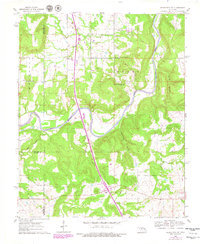
1962 Map of Henryetta SW
USGS Topo · Published 1979About this map
North Canadian River meanders through this portion of eastern Oklahoma, carving a wide valley between the rugged uplands of Ryals and Welleetka. The settlement of Hanna sits in the southern portion of the quadrangle, anchored by its proximity to the modern Indian Nation Toll Road (Turnpike). This era of mapping documents a landscape shaped by both spiritual and educational community centers, evidenced by a dense concentration of local institutions.
Find a feature on this map
29 named features on this map. Tap any name to fly to it.
Don’t see what you’re looking for? This feature index may not catch every label — zoom into the map to look around manually.
Map Details
Editions of this 1962 Henryetta SW Map
2 editions found
Other maps of this area

1900 · Canadian
USGS Topo · 1:125,000

1900 · Wewoka
USGS Topo · 1:125,000

1946 · Fort Smith
USGS Topo · 1:250,000

1954 · Oklahoma City
USGS Topo · 1:250,000

1957 · Oklahoma City
USGS Topo · 1:250,000

1962 · Henryetta
USGS Topo · 1:24,000

1962 · Raiford
USGS Topo · 1:24,000

1962 · Henryetta SW
USGS Topo · 1:24,000

1962 · Hoffman
USGS Topo · 1:24,000

1963 · Oklahoma City
USGS Topo · 1:250,000