
1963 Map of Eufaula
USGS Topo · Published 1964About this map
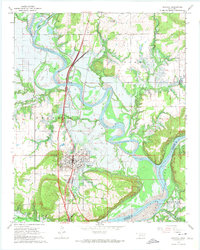
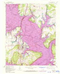
Eufaula is documented here just as the landscape was undergoing a massive transformation. The 1963 survey captures the area in the midst of the creation of the Eufaula Reservoir, with blue hatching indicating the significant acreage along the North Canadian River and Deep Fork slated for inundation. This transition from river valley to reservoir is evident in the planned flooding of bottomlands near Baptizing Creek and Possum Creek.
Find a feature on this map
23 named features on this map. Tap any name to fly to it.
Don’t see what you’re looking for? This feature index may not catch every label — zoom into the map to look around manually.
Map Details
Editions of this 1963 Eufaula Map
3 editions found
Other maps of this area

1900 · Sansbois
USGS Topo · 1:125,000

1900 · Canadian
USGS Topo · 1:125,000

1909 · Sans Bois
USGS Topo · 1:125,000

1911 · Sansbois
USGS Topo · 1:125,000

1946 · Fort Smith
USGS Topo · 1:250,000

1962 · Pierce
USGS Topo · 1:24,000

1963 · Warner NW
USGS Topo · 1:24,000

1963 · Stidham
USGS Topo · 1:24,000

1963 · Checotah
USGS Topo · 1:24,000

1963 · Texanna
USGS Topo · 1:24,000