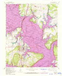
1963 Map of Eufaula
USGS Topo · Published 1993About this map
The town of Eufaula sits at the heart of this landscape, where the North Canadian River and the North Deep Fork Canadian River converge within the rising waters of Lake Eufaula. This 1963 survey, updated with 1991 aerial photography, documents the significant transformation of the terrain into a major reservoir environment. Cultural landmarks such as the West Eufaula Ch and Okfutkee Ch serve as anchors for the local community, while the Normal Reservation 1866 boundary line persists as a historical marker across the shifting shoreline.
Find a feature on this map
27 named features on this map. Tap any name to fly to it.
Don’t see what you’re looking for? This feature index may not catch every label — zoom into the map to look around manually.
Map Details
Editions of this 1963 Eufaula Map
3 editions found
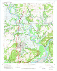
Other maps of this area

1900 · Sansbois
USGS Topo · 1:125,000

1900 · Canadian
USGS Topo · 1:125,000

1909 · Sans Bois
USGS Topo · 1:125,000

1911 · Sansbois
USGS Topo · 1:125,000

1946 · Fort Smith
USGS Topo · 1:250,000

1962 · Pierce
USGS Topo · 1:24,000

1963 · Warner NW
USGS Topo · 1:24,000

1963 · Stidham
USGS Topo · 1:24,000

1963 · Eufaula
USGS Topo · 1:24,000

1963 · Checotah
USGS Topo · 1:24,000