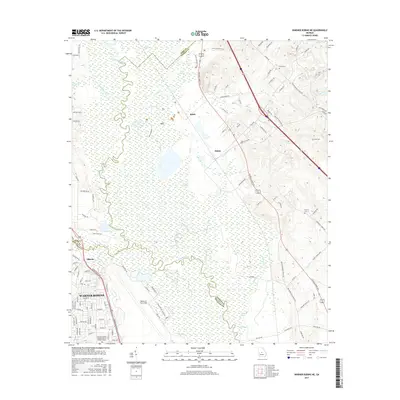
2017 Map of Warner Robins NE
USGS Topo · Published 2017About this map
The Ocmulgee River meanders through a sprawling wetland complex in central Georgia, defining the landscape between Warner Robins and the rural communities to the east. Extensive marshlands and oxbow features like Big Eddy and Bond Swamp dominate the central corridor, illustrating the river's historical floodplain. The confluence of Tobesofkee Cr and Stone Cr with the main river channel creates a complex network of waterways, including curiously named spots like Jack Hole and Eel Hole.
Find a feature on this map
115 named features on this map. Tap any name to fly to it.
Don’t see what you’re looking for? This feature index may not catch every label — zoom into the map to look around manually.
Map Details
Editions of this 2017 Warner Robins NE Map
This is the sole edition of this map. No revisions or reprints were ever made.
Other maps of this area

1956 · Gordon
USGS Topo · 1:62,500

1956 · Warner Robins
USGS Topo · 1:62,500

1956 · Jeffersonville
USGS Topo · 1:62,500

1956 · Macon West
USGS Topo · 1:24,000

1956 · Macon East
USGS Topo · 1:24,000

1956 · Macon
USGS Topo · 1:62,500

1957 · Macon
USGS Topo · 1:250,000

1958 · Macon
USGS Topo · 1:250,000

1964 · Macon
USGS Topo · 1:250,000

1973 · Warner Robins NE
USGS Topo · 1:24,000