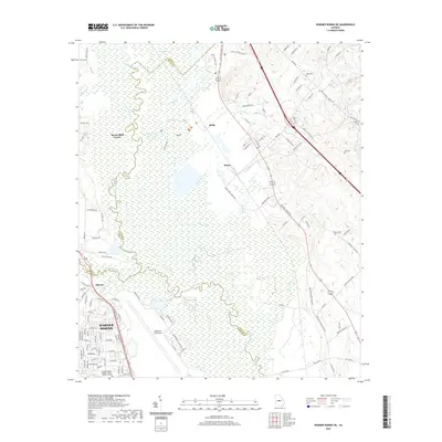
2020 Map of Warner Robins NE
USGS Topo · Published 2020About this map
The Ocmulgee River meanders through a sprawling wetland corridor, forming a natural boundary between Bibb, Twiggs, and Houston Counties. This hydrologic system is defined by expansive features like Rays Swamp, Denson Marsh, and the winding Echeconnee Creek. The landscape transitions from these low-lying bottomlands to the developed corridors of Warner Robins and the extensive grounds of Robins Air Force Base in the southwest. Smaller rural settlements such as Huber, Reids, and Elberta are scattered along the rising terrain east of the river. Genealogists may find value in the presence of several family or local burial grounds, including Bond Cem, Hale Cem, and Pearce Cem, which anchor the historical footprint of the community amidst modern military and educational institutions like the Georgia Military College - Warner Robins Campus.
Find a feature on this map
128 named features on this map. Tap any name to fly to it.
Don’t see what you’re looking for? This feature index may not catch every label — zoom into the map to look around manually.
Map Details
Editions of this 2020 Warner Robins NE Map
This is the sole edition of this map. No revisions or reprints were ever made.
Other maps of this area

1956 · Gordon
USGS Topo · 1:62,500

1956 · Warner Robins
USGS Topo · 1:62,500

1956 · Jeffersonville
USGS Topo · 1:62,500

1956 · Macon West
USGS Topo · 1:24,000

1956 · Macon East
USGS Topo · 1:24,000

1956 · Macon
USGS Topo · 1:62,500

1957 · Macon
USGS Topo · 1:250,000

1958 · Macon
USGS Topo · 1:250,000

1964 · Macon
USGS Topo · 1:250,000

1973 · Warner Robins NE
USGS Topo · 1:24,000