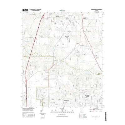
2017 Map of Warner Robins NW
USGS Topo · Published 2017About this map
Echeconnee Creek meanders through the heart of this landscape, forming a natural boundary as it flows toward the Middle Georgia Regional Airport. This 2017 survey reflects the significant suburban development and industrial infrastructure connecting the northern reaches of Warner Robins with southern Macon-Bibb County. Residential growth is evident in settlements like Skipperton, Walden, and Centerville, while the Norfolk Southern rail line provides a transit corridor through Sofkee and Avondale. Local history is anchored by sites such as the Jones Chapel Cem and Glen Haven Memorial Garden. The map details a complex network of county roads and interstate arteries that serve this expanding region, alongside smaller water bodies like Stokes Lake and Vinsons Lake.
Find a feature on this map
137 named features on this map. Tap any name to fly to it.
Don’t see what you’re looking for? This feature index may not catch every label — zoom into the map to look around manually.
Map Details
Editions of this 2017 Warner Robins NW Map
This is the sole edition of this map. No revisions or reprints were ever made.
Other maps of this area

1956 · Fort Valley
USGS Topo · 1:62,500

1956 · Bolingbroke
USGS Topo · 1:62,500

1956 · Warner Robins
USGS Topo · 1:62,500

1956 · Macon West
USGS Topo · 1:24,000

1956 · Macon East
USGS Topo · 1:24,000

1956 · Macon
USGS Topo · 1:62,500

1957 · Macon
USGS Topo · 1:250,000

1958 · Macon
USGS Topo · 1:250,000

1964 · Macon
USGS Topo · 1:250,000

1973 · Warner Robins NE
USGS Topo · 1:24,000