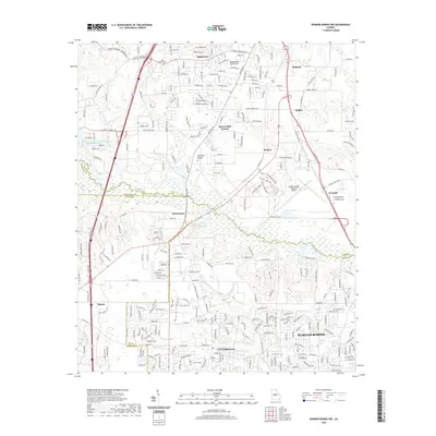
2020 Map of Warner Robins NW
USGS Topo · Published 2020About this map
Echeconnee Creek snakes across this landscape, defining the jurisdictional boundaries between Bibb, Crawford, Peach, and Houston counties. The map captures the suburban and industrial expansion surrounding the northern reaches of Warner Robins and Centerville, where residential developments increasingly abut older rural identifiers like Jones Chapel Cem and Skipperton. To the east, the Middle Georgia Regional Airport serves as a major logistical hub, complemented by the industrial corridors near Avondale and Walden. The transition from agricultural roots to modern transit is evident in the dense network of roads such as Hartley Bridge Rd and Sardis Church Rd, which link historical hamlets like Sofkee to the growing urban centers. Pockets of managed green space, including the Bridgewood Golf Course and Glen Haven Memorial Garden, highlight the evolving land use in this central Georgia corridor.
Find a feature on this map
54 named features on this map. Tap any name to fly to it.
Don’t see what you’re looking for? This feature index may not catch every label — zoom into the map to look around manually.
Map Details
Editions of this 2020 Warner Robins NW Map
This is the sole edition of this map. No revisions or reprints were ever made.
Other maps of this area

1956 · Fort Valley
USGS Topo · 1:62,500

1956 · Bolingbroke
USGS Topo · 1:62,500

1956 · Warner Robins
USGS Topo · 1:62,500

1956 · Macon West
USGS Topo · 1:24,000

1956 · Macon East
USGS Topo · 1:24,000

1956 · Macon
USGS Topo · 1:62,500

1957 · Macon
USGS Topo · 1:250,000

1958 · Macon
USGS Topo · 1:250,000

1964 · Macon
USGS Topo · 1:250,000

1973 · Warner Robins NE
USGS Topo · 1:24,000