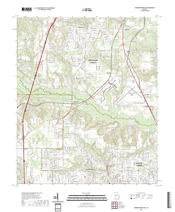
2024 Map of Warner Robins NW
USGS Topo · Published 2024About this map
Echeconnee Creek defines the transition between Bibb and Houston counties, serving as a natural anchor for the sprawling suburban development moving north from Warner Robins and west from Centerville. This modern survey illustrates the complex boundary intersections where Crawford, Peach, and Bibb counties converge near the community of Byron. The landscape is a mixture of dense residential grids and significant industrial and logistical infrastructure, most notably the Middle Georgia Regional Airport and the Norfolk Southern rail line.
Find a feature on this map
36 named features on this map. Tap any name to fly to it.
Don’t see what you’re looking for? This feature index may not catch every label — zoom into the map to look around manually.
Map Details
Editions of this 2024 Warner Robins NW Map
This is the sole edition of this map. No revisions or reprints were ever made.
Other maps of this area

1956 · Fort Valley
USGS Topo · 1:62,500

1956 · Bolingbroke
USGS Topo · 1:62,500

1956 · Warner Robins
USGS Topo · 1:62,500

1956 · Macon West
USGS Topo · 1:24,000

1956 · Macon East
USGS Topo · 1:24,000

1956 · Macon
USGS Topo · 1:62,500

1957 · Macon
USGS Topo · 1:250,000

1958 · Macon
USGS Topo · 1:250,000

1964 · Macon
USGS Topo · 1:250,000

1973 · Warner Robins NE
USGS Topo · 1:24,000