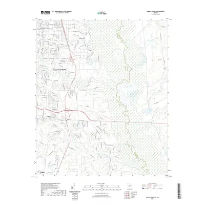
2020 Map of Warner Robins SE
USGS Topo · Published 2020About this map
The eastern edges of Warner Robins and the sprawling military installation at Robins AFB dominate the northwestern portion of this Houston County landscape. The area transitions from the dense street grids of neighborhoods like Lashley and Bonaire to the wide, swampy floodplain of the Ocmulgee River, which serves as the boundary between Houston and Twiggs counties. This contrast highlights the mid-20th-century expansion of the city alongside the preserved river bottomlands.
Find a feature on this map
37 named features on this map. Tap any name to fly to it.
Don’t see what you’re looking for? This feature index may not catch every label — zoom into the map to look around manually.
Map Details
Editions of this 2020 Warner Robins SE Map
This is the sole edition of this map. No revisions or reprints were ever made.
Other maps of this area

1956 · Cochran
USGS Topo · 1:62,500

1956 · Perry
USGS Topo · 1:62,500

1956 · Warner Robins
USGS Topo · 1:62,500

1956 · Jeffersonville
USGS Topo · 1:62,500

1957 · Macon
USGS Topo · 1:250,000

1958 · Macon
USGS Topo · 1:250,000

1964 · Macon
USGS Topo · 1:250,000

1973 · Hayneville
USGS Topo · 1:24,000

1973 · Warner Robins NE
USGS Topo · 1:24,000

1973 · Tarversville
USGS Topo · 1:24,000