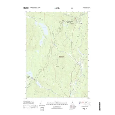
2018 Map of Warren
USGS Topo · Published 2018About this map
Warren and Glencliff anchor this landscape within the White Mountain National Forest, where the topography is defined by high peaks and an extensive network of water bodies. The Appalachian National Scenic Trail traverses the northern heights, passing over Webster Slide Mtn and Wyatt Hill near Wachipauka Pond. This 2018 survey reveals a terrain shaped by the Baker River and its many tributaries, including Berry Brook and Patch Brook, which drain the surrounding slopes.
Find a feature on this map
61 named features on this map. Tap any name to fly to it.
Don’t see what you’re looking for? This feature index may not catch every label — zoom into the map to look around manually.
Map Details
Editions of this 2018 Warren Map
This is the sole edition of this map. No revisions or reprints were ever made.
Other maps of this area

1928 · Rumney
USGS Topo · 1:62,500

1929 · Moosilauke
USGS Topo · 1:62,500

1931 · Mt. Cube
USGS Topo · 1:62,500

1931 · Woodsville
USGS Topo · 1:48,000

1932 · Rumney
USGS Topo · 1:62,500

1932 · Moosilauke
USGS Topo · 1:62,500

1933 · Mt. Cube
USGS Topo · 1:62,500

1935 · Woodsville
USGS Topo · 1:62,500

1941 · Woodsville
USGS Topo · 1:62,500

1949 · Portland
USGS Topo · 1:250,000