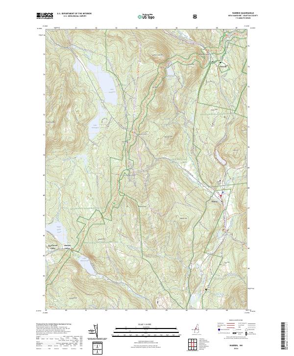
2024 Map of Warren
USGS Topo · Published 2024About this map
The Baker River valley anchors this study of New Hampshire's interior, where the settlement of Warren sits at the junction of Beech Hill Rd and Orford Rd. The landscape is defined by the high elevations of the White Mountain National Forest, including prominent peaks like Webster Slide Mtn and Sentinel Mtn. This corridor has long been a significant passage through the mountains, evidenced by the path of the Appalachian National Scenic Trail as it winds past Wachipauka Pond toward Oliverian Notch.
Find a feature on this map
78 named features on this map. Tap any name to fly to it.
Don’t see what you’re looking for? This feature index may not catch every label — zoom into the map to look around manually.
Map Details
Editions of this 2024 Warren Map
This is the sole edition of this map. No revisions or reprints were ever made.
Other maps of this area

1928 · Rumney
USGS Topo · 1:62,500

1929 · Moosilauke
USGS Topo · 1:62,500

1931 · Mt. Cube
USGS Topo · 1:62,500

1931 · Woodsville
USGS Topo · 1:48,000

1932 · Rumney
USGS Topo · 1:62,500

1932 · Moosilauke
USGS Topo · 1:62,500

1933 · Mt. Cube
USGS Topo · 1:62,500

1935 · Woodsville
USGS Topo · 1:62,500

1941 · Woodsville
USGS Topo · 1:62,500

1949 · Portland
USGS Topo · 1:250,000