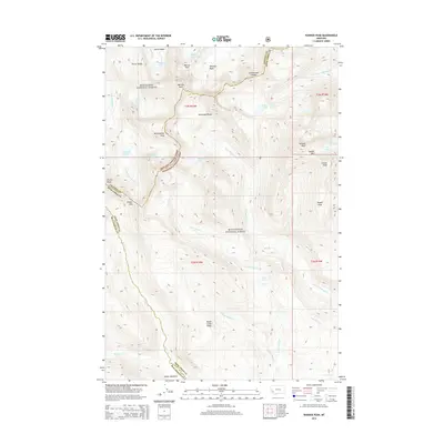
2014 Map of Warren Peak
USGS Topo · Published 2014About this map
Warren Peak stands as a prominent landmark along the crest of the Anaconda Range, where the Continental Divide carves a jagged path through the high country. This alpine landscape, shared by the Deerlodge National Forest and Beaverhead National Forest, is defined by its glacial basins and mountain passes. Natural collection points like Tamarack Lake and Upper Carpp Lake sit below Porter Ridge and the Warren Pass, while the drainage network descends through the W Fork Fishtrap Cr and Pintler Cr. The terrain is characterized by massive elevation shifts between summits like W Goat Peak and the low-lying Pintler Meadows. Historically significant as a primary watershed divide, the area remains an undeveloped expanse of wilderness where the headwaters of numerous creeks, including Palisade Cr and Calvert Cr, originate from the surrounding peaks and basins.
Find a feature on this map
43 named features on this map. Tap any name to fly to it.
Don’t see what you’re looking for? This feature index may not catch every label — zoom into the map to look around manually.
Map Details
Editions of this 2014 Warren Peak Map
This is the sole edition of this map. No revisions or reprints were ever made.
Other maps of this area

1908 · Philipsburg
USGS Topo · 1:125,000

1909 · Sapphire
USGS Topo · 1:125,000

1947 · Butte
USGS Topo · 1:250,000

1955 · Dillon
USGS Topo · 1:250,000

1957 · Dillon
USGS Topo · 1:250,000

1958 · Butte
USGS Topo · 1:250,000

1958 · Dillon
USGS Topo · 1:250,000

1960 · Butte
USGS Topo · 1:250,000

1962 · Butte
USGS Topo · 1:250,000

1962 · Dillon
USGS Topo · 1:250,000