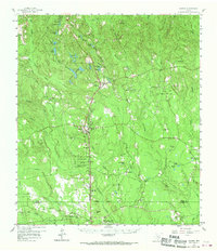
1958 Map of Warren
USGS Topo · Published 1970About this map
Warren and Hillister serve as the primary hubs in this Southeast Texas landscape, shaped by the logging and petroleum industries of the late 1950s. The Southern Pacific and Texas and New Orleans railroads track through the center of the sheet, connecting timber towns and facilitating the movement of crude from productive grounds like the East Hillister Oil Field and Swearingen Oil Field. Much of the central acreage is dedicated to the John H Kirby State Forest, reflecting early conservation efforts in the Piney Woods region.
Find a feature on this map
63 named features on this map. Tap any name to fly to it.
Don’t see what you’re looking for? This feature index may not catch every label — zoom into the map to look around manually.
Map Details
Editions of this 1958 Warren Map
3 editions found

Other maps of this area

1943 · Liberty
USGS Topo · 1:125,000

1954 · Beaumont
USGS Topo · 1:250,000

1955 · Saratoga
USGS Topo · 1:62,500

1955 · Silsbee
USGS Topo · 1:62,500

1955 · Kountze
USGS Topo · 1:62,500

1955 · Woodville
USGS Topo · 1:62,500

1955 · Camden
USGS Topo · 1:62,500

1955 · Curtis
USGS Topo · 1:62,500

1957 · Beaumont
USGS Topo · 1:250,000

1958 · Segno
USGS Topo · 1:62,500