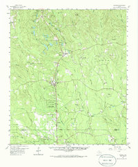
1958 Map of Warren
USGS Topo · Published 1986About this map
Southern Pacific rail lines and the Texas and New Orleans route drive the settlement patterns of this Tyler County landscape during the late 1950s. The map reveals a corridor of timber and resource extraction anchored by towns like Warren and Hillister, with the sprawling John H Kirby State Forest and the Hyatt Lookout serving as central landmarks for the region's forestry heritage.
Find a feature on this map
78 named features on this map. Tap any name to fly to it.
Don’t see what you’re looking for? This feature index may not catch every label — zoom into the map to look around manually.
Map Details
Editions of this 1958 Warren Map
3 editions found

Other maps of this area

1943 · Liberty
USGS Topo · 1:125,000

1954 · Beaumont
USGS Topo · 1:250,000

1955 · Saratoga
USGS Topo · 1:62,500

1955 · Silsbee
USGS Topo · 1:62,500

1955 · Kountze
USGS Topo · 1:62,500

1955 · Woodville
USGS Topo · 1:62,500

1955 · Camden
USGS Topo · 1:62,500

1955 · Curtis
USGS Topo · 1:62,500

1957 · Beaumont
USGS Topo · 1:250,000

1958 · Segno
USGS Topo · 1:62,500