
1955 Map of Kountze
USGS Topo · Published 1956About this map
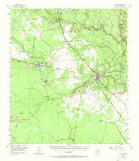
Kountze serves as the central hub for this mid-century look at the Piney Woods, where the intersection of timber and petroleum legacy is clearly visible. The landscape is defined by the Gulf Colorado and Santa Fe and Texas and New Orleans (Southern Pacific) railroads, which supported a network of smaller company settlements and mill sites. Local family history and genealogy are anchored by landmarks like Old Hardin, Honey Island, and Village Mills, along with several rural cemeteries such as Holland Cem and Olive Cem. Industrial development is evident through the widespread oil infrastructure, including the Nona Mills Oil Field and the South Hampton Oil Field. Beyond the towns, the terrain transitions into the dense Shaley Baygall and the low-lying Cypress Brake, reflecting the wet, wooded environment of the Big Thicket region during the 1950s.
Find a feature on this map
57 named features on this map. Tap any name to fly to it.
Don’t see what you’re looking for? This feature index may not catch every label — zoom into the map to look around manually.
Map Details
Editions of this 1955 Kountze Map
4 editions found
Other maps of this area

1932 · Beaumont
USGS Topo · 1:62,500

1943 · Liberty
USGS Topo · 1:125,000

1954 · Beaumont
USGS Topo · 1:250,000

1955 · Daisetta
USGS Topo · 1:62,500

1955 · Saratoga
USGS Topo · 1:62,500

1955 · Silsbee
USGS Topo · 1:62,500

1955 · Sour Lake
USGS Topo · 1:62,500

1957 · Beaumont
USGS Topo · 1:250,000

1958 · Segno
USGS Topo · 1:62,500

1958 · Warren
USGS Topo · 1:62,500