
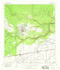
1955 Map of Sour Lake
USGS Topo · Published 1956About this map
Sour Lake and its surrounding prairies dominate this mid-century landscape where the oil industry meets the coastal plains. The Sour Lake Dome and Nome Oil Field indicate the region's petroleum importance, marked by sprawling networks of Tank Farms and oil tanks. The settlement pattern is defined by the intersection of rail and road, with the Texas and New Orleans (Southern Pacific) and Missouri Pacific railroads connecting rural hubs like Grayburg and Nome.
Find a feature on this map
68 named features on this map. Tap any name to fly to it.
Don’t see what you’re looking for? This feature index may not catch every label — zoom into the map to look around manually.
Map Details
Editions of this 1955 Sour Lake Map
2 editions found
Other maps of this area

1932 · Beaumont
USGS Topo · 1:62,500

1943 · Whites Bayou
USGS Topo · 1:24,000

1943 · Liberty
USGS Topo · 1:125,000

1943 · Fannett East
USGS Topo · 1:24,000

1945 · Fannett East
USGS Topo · 1:31,680

1945 · Nolte
USGS Topo · 1:31,680

1950 · Houston
USGS Topo · 1:250,000

1954 · Beaumont
USGS Topo · 1:250,000

1955 · Daisetta
USGS Topo · 1:62,500

1955 · Saratoga
USGS Topo · 1:62,500