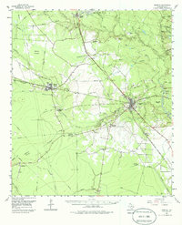
1955 Map of Kountze
USGS Topo · Published 1986About this map
The county seat of Kountze stands at the junction of the Gulf Colorado and Santa Fe and the Texas and New Orleans railroads, serving as a hub for the region's timber and petroleum industries. To the south, the settlement of Old Hardin represents the former county seat, while the Kirby Lumber Tram and various old railroad grades reveal the heavy footprint of historical logging. The landscape is a mix of dense baygalls and cypress brakes, with Village Creek winding south toward the coastal plain.
Find a feature on this map
53 named features on this map. Tap any name to fly to it.
Don’t see what you’re looking for? This feature index may not catch every label — zoom into the map to look around manually.
Map Details
Editions of this 1955 Kountze Map
4 editions found
Other maps of this area

1932 · Beaumont
USGS Topo · 1:62,500

1943 · Liberty
USGS Topo · 1:125,000

1954 · Beaumont
USGS Topo · 1:250,000

1955 · Daisetta
USGS Topo · 1:62,500

1955 · Saratoga
USGS Topo · 1:62,500

1955 · Silsbee
USGS Topo · 1:62,500

1955 · Kountze
USGS Topo · 1:62,500

1955 · Sour Lake
USGS Topo · 1:62,500

1957 · Beaumont
USGS Topo · 1:250,000

1958 · Segno
USGS Topo · 1:62,500