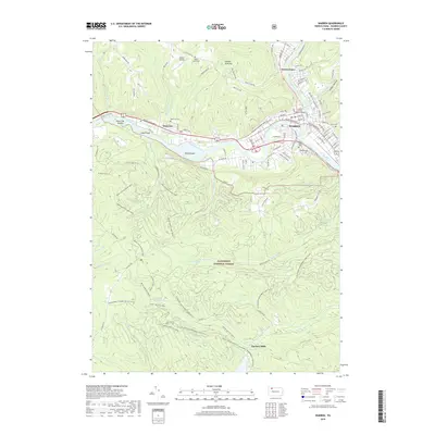
2019 Map of Warren
USGS Topo · Published 2019About this map
The Allegheny River and Conewango Creek converge at the heart of Warren, the seat of government marked by the Warren County Courthouse. This 2019 survey captures the developed river valley as it transitions into the densely wooded tracts of the Allegheny National Forest to the south. The landscape is defined by the winding river channel, which contains several large landmasses including Grass Flat Island, Leek Island, and Mead Island.
Find a feature on this map
108 named features on this map. Tap any name to fly to it.
Don’t see what you’re looking for? This feature index may not catch every label — zoom into the map to look around manually.
Map Details
Editions of this 2019 Warren Map
This is the sole edition of this map. No revisions or reprints were ever made.
Other maps of this area

1906 · Warren
USGS Topo · 1:62,500

1907 · Warren
USGS Topo · 1:62,500

1908 · Warren
USGS Topo · 1:62,500

1926 · Youngsville
USGS Topo · 1:62,500

1927 · Tidioute
USGS Topo · 1:48,000

1929 · Youngsville
USGS Topo · 1:62,500

1930 · Tidioute
USGS Topo · 1:62,500

1935 · Sheffield
USGS Topo · 1:48,000

1941 · Sheffield
USGS Topo · 1:62,500

1943 · Youngsville
USGS Topo · 1:62,500