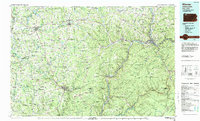
1983 Map of Warren
USGS Topo · Published 1984About this map
The Allegheny River and its major tributaries, including Brokenstraw Creek and Conewango Creek, carve a deep path through the northwestern Pennsylvania plateau. This 1980s landscape is a study in the intersection of early American industry and conservation, where vast Oil Fields and Gas Fields overlap with protected lands like the Allegheny National Forest and Cornplanter State Forest. The map documents the region's industrial heritage at Drake Well Memorial Park near Titusville, marking the birthplace of the modern petroleum industry, alongside the Pithole City Historical Site.
Find a feature on this map
140 named features on this map. Tap any name to fly to it.
Don’t see what you’re looking for? This feature index may not catch every label — zoom into the map to look around manually.
Map Details
Editions of this 1983 Warren Map
This is the sole edition of this map. No revisions or reprints were ever made.
Other maps of this area

1899 · Erie
USGS Topo · 1:62,500

1900 · Erie
USGS Topo · 1:62,500

1904 · Chautaqua
USGS Topo · 1:62,500

1905 · Clymer
USGS Topo · 1:62,500

1905 · Jamestown
USGS Topo · 1:62,500

1906 · Warren
USGS Topo · 1:62,500

1907 · Warren
USGS Topo · 1:62,500

1908 · Warren
USGS Topo · 1:62,500

1909 · Franklin
USGS Topo · 1:62,500

1911 · Franklin
USGS Topo · 1:62,500