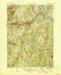
1946 Map of Warren
USGS Topo · Published 1946About this map
The Quaboag River valley defines the industrial and transportation corridor of this mid-1940s survey, where the Boston and Albany RR tracks parallel the water through the manufacturing centers of Warren and West Warren. These settlements are concentrated along the narrow valley floor, surrounded by high ground such as Marks Mountain and Coys Hill. The map captures a moment when the rural character of the hills remained intact, as evidenced by the distribution of country schools like Schoolhouse No 4 and local burials at St Marys Cem.
Find a feature on this map
37 named features on this map. Tap any name to fly to it.
Don’t see what you’re looking for? This feature index may not catch every label — zoom into the map to look around manually.
Map Details
Editions of this 1946 Warren Map
3 editions found
Other maps of this area

1887 · Brookfield
USGS Topo · 1:62,500

1887 · Palmer
USGS Topo · 1:62,500

1887 · Belchertown
USGS Topo · 1:62,500

1887 · Barre
USGS Topo · 1:62,500

1889 · Palmer
USGS Topo · 1:62,500

1889 · Barre
USGS Topo · 1:62,500

1890 · Belchertown
USGS Topo · 1:62,500

1890 · Brookfield
USGS Topo · 1:62,500

1893 · Palmer
USGS Topo · 1:62,500

1893 · Belchertown
USGS Topo · 1:62,500