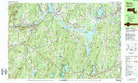
1982 Map of Warren
USGS Topo · Published 1984About this map
The Quaboag River valley serves as a central corridor for this 1980s landscape, connecting the industrial and residential hubs of Warren, West Warren, and Brookfield. The terrain is characterized by a series of prominent peaks such as Marks Mountain, Hitchcock Mountain, and Mt Dan, which separate the river valley from large wetlands like Ball Swamp and Allen Swamp. Transportation infrastructure is highly developed, with the Massachusetts Turnpike cutting across the southern portion of the map while the Conrail line follows the natural curve of the river through the northern settlements.
Find a feature on this map
86 named features on this map. Tap any name to fly to it.
Don’t see what you’re looking for? This feature index may not catch every label — zoom into the map to look around manually.
Map Details
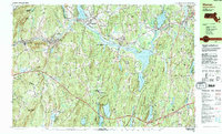
Editions of this 1982 Warren Map
2 editions found
Other maps of this area

1885 · Worcester
USGS Topo · 1:62,500

1886 · Worcester
USGS Topo · 1:62,500

1887 · Brookfield
USGS Topo · 1:62,500

1887 · Palmer
USGS Topo · 1:62,500

1887 · Belchertown
USGS Topo · 1:62,500

1887 · Barre
USGS Topo · 1:62,500

1889 · Webster
USGS Topo · 1:62,500

1889 · Palmer
USGS Topo · 1:62,500

1889 · Barre
USGS Topo · 1:62,500

1890 · Belchertown
USGS Topo · 1:62,500