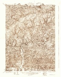
1930 Map of Warrensville
USGS Topo · Published 1930About this map
The Pennsylvania RR corridor through the Lycoming Creek valley anchors this 1930 survey, illustrating the critical transportation link between Ralston and the urban fringes of Williamsport. This era represents a transition from heavy resource extraction to a more settled rural landscape, evidenced by the numerous mountain schools like Wallis Run Sch and McLaughlin Sch scattered throughout the highlands. The map captures the industrial legacy of the region in Coal Mine Hollow and the active upland communities at Proctor and Kellyburg. Downstream, the settlement pattern shifts toward the agriculture and infrastructure of the West Branch Susquehanna valley, featuring the County Farm and the emerging suburbs of Faxon and Lynehurst. The intricate network of drainage from Loyalsock Creek and its branches reflects the complex geography that shaped early logging and farming in Lycoming County.
Find a feature on this map
81 named features on this map. Tap any name to fly to it.
Don’t see what you’re looking for? This feature index may not catch every label — zoom into the map to look around manually.
Map Details
Editions of this 1930 Warrensville Map
3 editions found
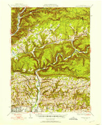
Other maps of this area

1921 · Williamsport
USGS Topo · 1:48,000

1921 · Trout Run
USGS Topo · 1:62,500

1923 · Trout Run
USGS Topo · 1:62,500

1923 · Williamsport
USGS Topo · 1:62,500

1924 · Milton
USGS Topo · 1:62,500

1925 · Blossburg
USGS Topo · 1:62,500

1927 · Eagles Mere
USGS Topo · 1:48,000

1927 · Blossburg
USGS Topo · 1:62,500

1930 · Warrensville
USGS Topo · 1:62,500

1932 · Eagle Mere
USGS Topo · 1:62,500
Featured Places
- Williamsport, PA
- Faxon, Loyalsock Township
- Hillsgrove Township, PA
- Butternut Grove, Gamble Township
- North Eldred, Eldred Township