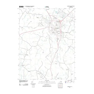
2011 Map of Warrenton
USGS Topo · Published 2011About this map
Warrenton serves as the focal point for this Fauquier County survey, where the town's dense network of streets and historic corridors like Lovers Ln and Meetze Rd transition into the surrounding countryside. To the southwest, the Rappahannock River defines the edge of the quadrangle, passing near the historic grounds of Fauquier White Sulphur Springs. The landscape is dotted with established estates and small clusters such as Lousetown, Frytown, and Fletcherville, reflecting the area's long-standing agricultural and residential development. Local aviation and utility infrastructure is also well-represented, from the Warrenton Reservoir and Warrenton Dam to the Warrenton Air Park and Aviacres Airport. Genealogists may find particular value in the detailed layout of the Warrenton Cemetery and the various named farms, such as Oakwood Farm, that signify the region's landownership patterns during this period.
Find a feature on this map
68 named features on this map. Tap any name to fly to it.
Don’t see what you’re looking for? This feature index may not catch every label — zoom into the map to look around manually.
Map Details
Editions of this 2011 Warrenton Map
This is the sole edition of this map. No revisions or reprints were ever made.
Other maps of this area

1894 · Warrenton
USGS Topo · 1:125,000

1894 · Warrenton
USGS Topo · 1:62,500

1927 · Remington
USGS Topo · 1:48,000

1930 · Warrenton
USGS Topo · 1:62,500

1933 · Middleburg
USGS Topo · 1:62,500

1943 · Catlett
USGS Topo · 1:62,500

1943 · Thorofare Gap
USGS Topo · 1:24,000

1943 · Orlean
USGS Topo · 1:24,000

1943 · Midland
USGS Topo · 1:24,000

1943 · Marshall
USGS Topo · 1:24,000