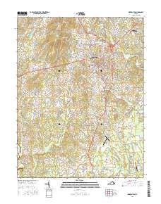
2016 Map of Warrenton
USGS Topo · Published 2016About this map
Warrenton sits at the heart of this landscape, serving as a hub for both historic settlement and modern infrastructure in the eastern foothills of the Blue Ridge. To the north, the terrain rises toward Viewtree Mtn, while the southern expanse transitions into the Culpeper Basin. The map shows a well-defined suburban and rural network, from the campus of the Lord Fairfax Community Coll Fauquier Campus to the clustered burials at Warrenton Cem.
Find a feature on this map
161 named features on this map. Tap any name to fly to it.
Don’t see what you’re looking for? This feature index may not catch every label — zoom into the map to look around manually.
Map Details
Editions of this 2016 Warrenton Map
This is the sole edition of this map. No revisions or reprints were ever made.
Other maps of this area

1894 · Warrenton
USGS Topo · 1:125,000

1894 · Warrenton
USGS Topo · 1:62,500

1927 · Remington
USGS Topo · 1:48,000

1930 · Warrenton
USGS Topo · 1:62,500

1933 · Middleburg
USGS Topo · 1:62,500

1943 · Catlett
USGS Topo · 1:62,500

1943 · Thorofare Gap
USGS Topo · 1:24,000

1943 · Orlean
USGS Topo · 1:24,000

1943 · Midland
USGS Topo · 1:24,000

1943 · Marshall
USGS Topo · 1:24,000