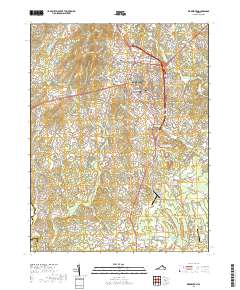
2019 Map of Warrenton
USGS Topo · Published 2019About this map
Warrenton serves as the focal point of this Fauquier County landscape, where the Fauquier County Courthouse and the extensive Warrenton Cem anchor the historic town center. The settlement pattern radiates outward to smaller outlying communities like Fletcherville, Frytown, and Meetze, reflecting a transition from the urbanized county seat to the agrarian and residential outskirts. To the south and west, the terrain becomes defined by watercourses and hills, including Bear Wallow Mtn and Viewtree Mtn.
Find a feature on this map
180 named features on this map. Tap any name to fly to it.
Don’t see what you’re looking for? This feature index may not catch every label — zoom into the map to look around manually.
Map Details
Editions of this 2019 Warrenton Map
This is the sole edition of this map. No revisions or reprints were ever made.
Other maps of this area

1894 · Warrenton
USGS Topo · 1:125,000

1894 · Warrenton
USGS Topo · 1:62,500

1927 · Remington
USGS Topo · 1:48,000

1930 · Warrenton
USGS Topo · 1:62,500

1933 · Middleburg
USGS Topo · 1:62,500

1943 · Catlett
USGS Topo · 1:62,500

1943 · Thorofare Gap
USGS Topo · 1:24,000

1943 · Orlean
USGS Topo · 1:24,000

1943 · Midland
USGS Topo · 1:24,000

1943 · Marshall
USGS Topo · 1:24,000