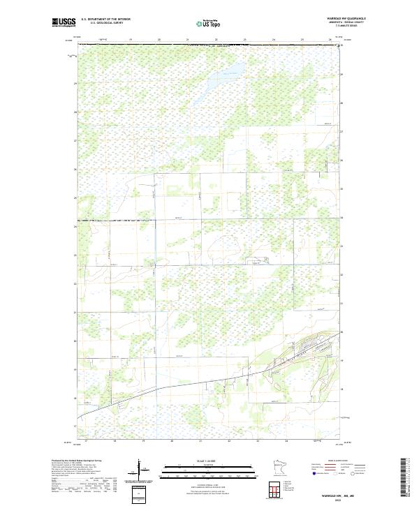
2022 Map of Warroad NW
USGS Topo · Published 2022About this map
Marvin Lake and the subtle rise of Lone Pine Ridge dominate this northern landscape along the international border of the United States of America. The terrain is characterized by a dense network of sectional roads and extensive wetlands, reflecting the unique topography of northern Roseau County. Settlement is concentrated in the southern portion of the quadrangle, where a neighborhood grid emerges including Main St, 1st St N, Birchwood Dr, and Pine Ridge Rd. The survey meticulously documents the Public Land Survey System divisions, from t164n r38w down to t162n r37w, providing a precise framework for property researchers and local historians tracing land ownership near the Canadian border. This modern record captures the transition from undeveloped wetland to organized residential pockets and county thoroughfares like Co Rd 133.
Find a feature on this map
32 named features on this map. Tap any name to fly to it.
Don’t see what you’re looking for? This feature index may not catch every label — zoom into the map to look around manually.
Map Details
Editions of this 2022 Warroad NW Map
This is the sole edition of this map. No revisions or reprints were ever made.
Other maps of this area

1918 · Goos
USGS Topo · 1:62,500

1918 · Warroad
USGS Topo · 1:62,500

1943 · Goos
USGS Topo · 1:62,500

1943 · Warroad
USGS Topo · 1:62,500

1954 · Roseau
USGS Topo · 1:250,000

1957 · Roseau
USGS Topo · 1:250,000

1958 · Roseau
USGS Topo · 1:250,000

1963 · Kenora
USGS Topo · 1:250,000
1966 · Salol
USGS Topo · 1:24,000
1966 · Salol NE
USGS Topo · 1:24,000