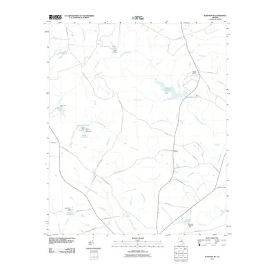
2011 Map of Warthen NE
USGS Topo · Published 2011About this map
The Little Ogeechee River and its numerous tributaries define this section of Washington County, where a legacy of water management is visible through an extensive network of millponds and dams. Significant impoundments like Hamburg Millpond, Burgamy Millpond, and the dual Adams Pond North and Adams Pond South suggest a landscape deeply shaped by historical milling and agricultural needs.
Find a feature on this map
56 named features on this map. Tap any name to fly to it.
Don’t see what you’re looking for? This feature index may not catch every label — zoom into the map to look around manually.
Map Details
Editions of this 2011 Warthen NE Map
This is the sole edition of this map. No revisions or reprints were ever made.
Other maps of this area

1953 · Athens
USGS Topo · 1:250,000

1958 · Athens
USGS Topo · 1:250,000

1959 · Athens
USGS Topo · 1:250,000

1960 · Warthen NE
USGS Topo · 1:24,000

1961 · Deepstep
USGS Topo · 1:24,000

1961 · Warthen
USGS Topo · 1:24,000

1961 · Warthen NW
USGS Topo · 1:24,000

1963 · Athens
USGS Topo · 1:250,000

1971 · Beall Springs
USGS Topo · 1:24,000
1972 · Downs
USGS Topo · 1:24,000