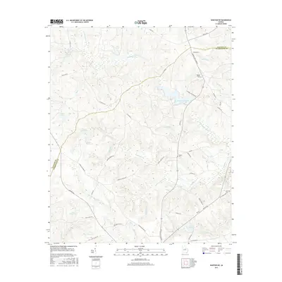
2017 Map of Warthen NE
USGS Topo · Published 2017About this map
The Little Ogeechee River and its numerous tributaries, such as Coupen Creek and Williamson Swamp Cr, define the drainage patterns of this rural Georgia landscape. The map reveals a transition between aquatic systems and agricultural road networks, centered around notable water bodies like Hamburgh Millpond and Burgamy Millpond. These millponds, along with Aiken Pond and Ralph Walker Lake, suggest a long-standing reliance on local hydrology for both industry and recreation in this part of Washington County.
Find a feature on this map
58 named features on this map. Tap any name to fly to it.
Don’t see what you’re looking for? This feature index may not catch every label — zoom into the map to look around manually.
Map Details
Editions of this 2017 Warthen NE Map
This is the sole edition of this map. No revisions or reprints were ever made.
Other maps of this area

1953 · Athens
USGS Topo · 1:250,000

1958 · Athens
USGS Topo · 1:250,000

1959 · Athens
USGS Topo · 1:250,000

1960 · Warthen NE
USGS Topo · 1:24,000

1961 · Deepstep
USGS Topo · 1:24,000

1961 · Warthen
USGS Topo · 1:24,000

1961 · Warthen NW
USGS Topo · 1:24,000

1963 · Athens
USGS Topo · 1:250,000

1971 · Beall Springs
USGS Topo · 1:24,000
1972 · Downs
USGS Topo · 1:24,000