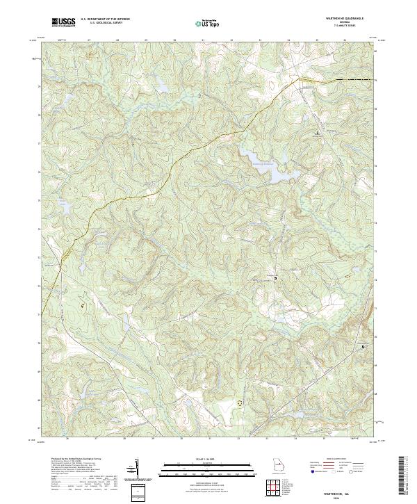
2024 Map of Warthen NE
USGS Topo · Published 2024About this map
The Little Ogeechee River and Williamson Swamp Creek define the hydrologic character of this border region between Hancock and Washington counties. The landscape is marked by numerous impoundments and mill sites, most notably Hamburgh Millpond and the smaller Burgamy Millpond to the south. These water features, alongside others like Adams Pond North and Ralph Walker Lake, suggest a long history of water-driven land use and private estate development in this part of Georgia.
Find a feature on this map
61 named features on this map. Tap any name to fly to it.
Don’t see what you’re looking for? This feature index may not catch every label — zoom into the map to look around manually.
Map Details
Editions of this 2024 Warthen NE Map
This is the sole edition of this map. No revisions or reprints were ever made.
Other maps of this area

1953 · Athens
USGS Topo · 1:250,000

1958 · Athens
USGS Topo · 1:250,000

1959 · Athens
USGS Topo · 1:250,000

1960 · Warthen NE
USGS Topo · 1:24,000

1961 · Deepstep
USGS Topo · 1:24,000

1961 · Warthen
USGS Topo · 1:24,000

1961 · Warthen NW
USGS Topo · 1:24,000

1963 · Athens
USGS Topo · 1:250,000

1971 · Beall Springs
USGS Topo · 1:24,000
1972 · Downs
USGS Topo · 1:24,000