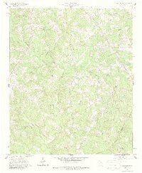
1961 Map of Warthen NW
USGS Topo · Published 1987About this map
The rolling landscape of eastern Georgia is defined by the drainage networks of Buffalo Creek and Pinkston Creek in this early 1960s survey. The map reveals a rural community structure rooted in small churches and family burial grounds, such as Knowles Chapel, Shiver Grove Ch, and the Frasier Cem. The presence of several Fire Break labels and various Trail and Jeep Trail routes suggests a managed timber or agricultural environment. A small Borrow Pit and the Galilee Sch further anchor the settlement patterns along the county line between Hancock Co and Washington Co. These features collectively represent a quiet, mid-century rural South, where the placement of institutions like Sandy Run Ch and Union Ch follows the natural contours of the hills and stream valleys.
Find a feature on this map
27 named features on this map. Tap any name to fly to it.
Don’t see what you’re looking for? This feature index may not catch every label — zoom into the map to look around manually.
Map Details
Editions of this 1961 Warthen NW Map
2 editions found
Other maps of this area

1912 · Milledgeville
USGS Topo · 1:62,500

1953 · Athens
USGS Topo · 1:250,000

1958 · Athens
USGS Topo · 1:250,000

1959 · Athens
USGS Topo · 1:250,000

1960 · Warthen NE
USGS Topo · 1:24,000

1961 · Deepstep
USGS Topo · 1:24,000

1961 · Warthen
USGS Topo · 1:24,000

1961 · Warthen NW
USGS Topo · 1:24,000

1963 · Athens
USGS Topo · 1:250,000

1972 · Shoulderbone
USGS Topo · 1:24,000