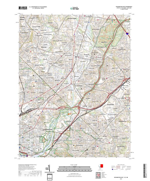
2023 Map of Washington East
USGS Topo · Published 2023About this map
The Anacostia River and its major tributaries, including the Northwest Branch Anacostia River and Paint Branch, anchor this detailed look at the borderlands where the District of Columbia and Maryland meet. This urban and suburban corridor is characterized by significant institutional landscapes and sprawling parklands, from the University of Maryland campus and adjacent College Park Airport in the north to the Catholic University of America and Gallaudet University further south. The map documents an area deeply layered with memorial and sacred sites, featuring numerous large burial grounds such as Fort Lincoln Cem, Mount Olivet Cem, and the Congressional Cem. Between the established neighborhoods of Silver Spring and Mount Rainier, the terrain is punctuated by landmarks like Mount Saint Sepulchre and the protected woods of Greenbelt Park.
Find a feature on this map
168 named features on this map. Tap any name to fly to it.
Don’t see what you’re looking for? This feature index may not catch every label — zoom into the map to look around manually.
Map Details
Editions of this 2023 Washington East Map
This is the sole edition of this map. No revisions or reprints were ever made.
Other maps of this area

1890 · Mt. Vernon
USGS Topo · 1:125,000

1891 · Mt. Vernon
USGS Topo · 1:125,000

1892 · Laurel
USGS Topo · 1:62,500

1893 · Frederick
USGS Topo · 1:125,000

1894 · Laurel
USGS Topo · 1:62,500

1894 · Frederick
USGS Topo · 1:125,000

1894 · Mt. Vernon
USGS Topo · 1:125,000

1897 · Laurel
USGS Topo · 1:62,500

1897 · Mt. Vernon
USGS Topo · 1:125,000

1899 · Patuxent
USGS Topo · 1:125,000