2021 Map of Washington East
USGS Topo · Published 2021About this map
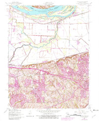
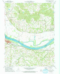
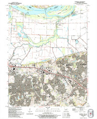
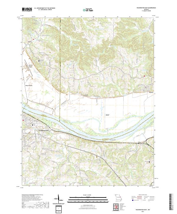
The Missouri River carves a deep bend through this landscape, marking the boundary between St. Charles, Franklin, and Warren counties. The northern bank is characterized by the agricultural expanse of Hancock Bottom and the historic river town of Augusta, where the street grid of Main St and High St meets the legendary Katy Trl rail-trail. On the southern bank, the city of Washington serves as a regional hub, featuring the Saint Peters Cem and the nearby Washington Regional Airport.
Find a feature on this map
113 named features on this map. Tap any name to fly to it.
Don’t see what you’re looking for? This feature index may not catch every label — zoom into the map to look around manually.
Map Details
Editions of this 2021 Washington East Map
This is the sole edition of this map. No revisions or reprints were ever made.
Historical Maps of Nona Through Time
6 maps found