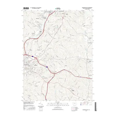
2016 Map of Washington East
USGS Topo · Published 2016About this map
Washington and East Washington anchor the western edge of this landscape, where the academic grounds of Washington & Jefferson Coll sit near Penn Commercial Inc. The terrain is defined by a dense network of suburban development and historical markers, such as the Brady Tunnel and several significant burial grounds, including The Old Immaculate Conception Cem and Saint Johns Cem. Moving east from the city center, the topography transitions into the rolling hills of South Strabane and Zediker. Water features like Maplewood Lake, Grims Lake, and the winding Chartiers Creek provide natural breaks in the residential corridors of Meadow Lands, Boon Terrace, and Eighty Four. This survey captures a modern snapshot of a region where the legacy of early settlements like Laboratory and Vance continues to shape the contemporary infrastructure of Washington County.
Find a feature on this map
175 named features on this map. Tap any name to fly to it.
Don’t see what you’re looking for? This feature index may not catch every label — zoom into the map to look around manually.
Map Details
Editions of this 2016 Washington East Map
This is the sole edition of this map. No revisions or reprints were ever made.
Other maps of this area

1901 · Amity
USGS Topo · 1:62,500

1904 · Amity
USGS Topo · 1:62,500

1904 · Carnegie
USGS Topo · 1:62,500

1904 · Burgettstown
USGS Topo · 1:62,500

1906 · Burgettstown
USGS Topo · 1:62,500

1906 · Carnegie
USGS Topo · 1:62,500

1907 · Claysville
USGS Topo · 1:62,500

1908 · Carnegie
USGS Topo · 1:62,500

1951 · Canton
USGS Topo · 1:250,000

1953 · Canton
USGS Topo · 1:250,000
Featured Places
- Washington, PA
- South Strabane Township, PA
- Mount Pleasant, South Strabane Township
- McGovern, Chartiers Township
- East Washington, PA