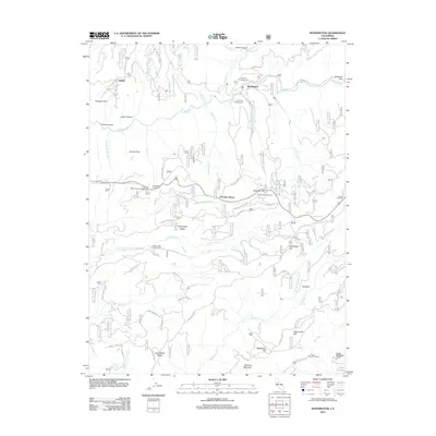
2012 Map of Washington
USGS Topo · Published 2012About this map
Washington sits at the heart of this Nevada County landscape, where the S Yuba River and Washington Cr meet. The area’s industrial and settlement history is marked by small locales like Relief, Junction House, and Excelsior, alongside power infrastructure including the Deer Creek Powerhouse and Drum Powerhouse near the Bear River. The terrain is defined by a series of named ridges and flats, such as Chalk Bluff Ridge, Skillman Flat, and Holbrook Flat, reflecting the complex geography of the Sierra Nevada foothills. Evidence of historical water management for mining or power is visible through the Upper Boardman Canal and Canal Spur A. For genealogists and local historians, family-named sites like Dana Ranch and landmarks such as Negro Jack Hill and McGuire Mountain provide specific points of interest for tracing early land use and settlement patterns in this river-cut terrain.
Find a feature on this map
69 named features on this map. Tap any name to fly to it.
Don’t see what you’re looking for? This feature index may not catch every label — zoom into the map to look around manually.
Map Details
Editions of this 2012 Washington Map
This is the sole edition of this map. No revisions or reprints were ever made.
Other maps of this area

1891 · Colfax
USGS Topo · 1:125,000

1892 · Colfax
USGS Topo · 1:125,000

1894 · Colfax
USGS Topo · 1:125,000

1898 · Colfax
USGS Topo · 1:125,000

1900 · Colfax
USGS Topo · 1:125,000

1902 · Colfax
USGS Topo · 1:125,000

1938 · Colfax
USGS Topo · 1:125,000

1949 · Chicago Park
USGS Topo · 1:24,000
1949 · North Bloomfield
USGS Topo · 1:24,000
1949 · Pike
USGS Topo · 1:24,000