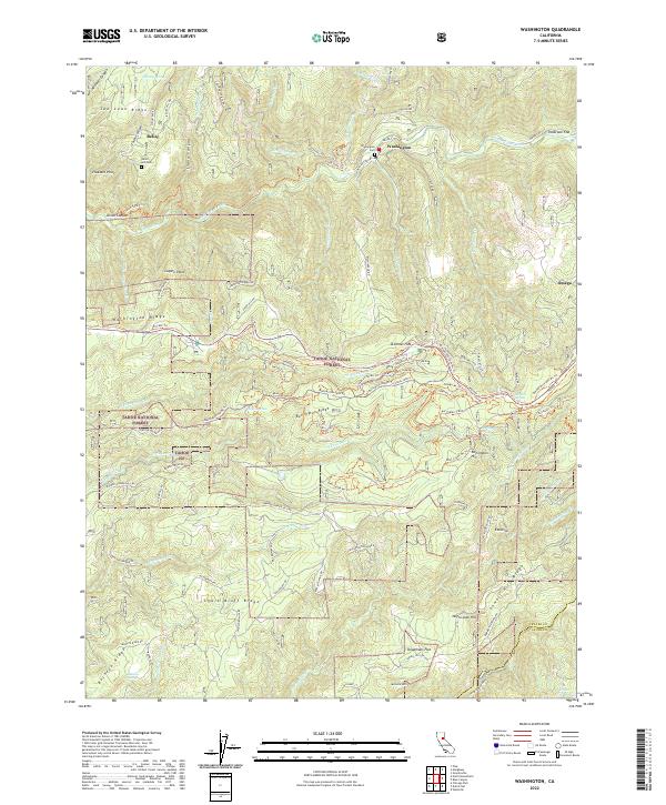
2022 Map of Washington
USGS Topo · Published 2022About this map
Washington sits at the heart of this landscape, positioned along the banks of the South Yuba River and surrounded by the steep terrain of the Tahoe National Forest. The map documents a region deeply shaped by its mining and hydraulic history, evidenced by features like the Big Tunnel and the remnants of historic water systems like the Yuba Canal and Cascade Canal. These industrial traces are interwoven with high-altitude settlements and localities such as Relief, Omega, and Excelsior, reflecting the area's legacy of resource extraction.
Find a feature on this map
98 named features on this map. Tap any name to fly to it.
Don’t see what you’re looking for? This feature index may not catch every label — zoom into the map to look around manually.
Map Details
Editions of this 2022 Washington Map
This is the sole edition of this map. No revisions or reprints were ever made.
Other maps of this area

1891 · Colfax
USGS Topo · 1:125,000

1892 · Colfax
USGS Topo · 1:125,000

1894 · Colfax
USGS Topo · 1:125,000

1898 · Colfax
USGS Topo · 1:125,000

1900 · Colfax
USGS Topo · 1:125,000

1902 · Colfax
USGS Topo · 1:125,000

1938 · Colfax
USGS Topo · 1:125,000

1949 · Chicago Park
USGS Topo · 1:24,000
1949 · North Bloomfield
USGS Topo · 1:24,000
1949 · Pike
USGS Topo · 1:24,000