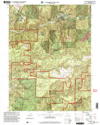
2000 Map of Washington
USGS Topo · Published 2003About this map
The South Fork Yuba River carves through this corner of the Tahoe National Forest, defining a landscape heavily shaped by hydraulic and hard-rock mining. The town of Washington sits along the riverbanks, serving as a hub for the various diggings and claims that pepper the surrounding ridges. Deep historical layers are evident in the complex network of trails, where the Overland Emigrant Trail and Pioneer Trail cross the rugged terrain of Washington Ridge and Burning Moscow Ridge. Extensive mining remnants, such as the Alpha Diggings, Omega Diggings, and the Zeibright Mine, highlight the industrial heritage of the Nevada Placer boundary region. Further south, the Bear River and Greenhorn Creek drainage basins show the continued reliance on water management for mineral extraction at sites like the Deer Creek Forebay.
Find a feature on this map
47 named features on this map. Tap any name to fly to it.
Don’t see what you’re looking for? This feature index may not catch every label — zoom into the map to look around manually.
Map Details
Editions of this 2000 Washington Map
This is the sole edition of this map. No revisions or reprints were ever made.
Other maps of this area

1891 · Colfax
USGS Topo · 1:125,000

1892 · Colfax
USGS Topo · 1:125,000

1894 · Colfax
USGS Topo · 1:125,000

1898 · Colfax
USGS Topo · 1:125,000

1900 · Colfax
USGS Topo · 1:125,000

1902 · Colfax
USGS Topo · 1:125,000

1938 · Colfax
USGS Topo · 1:125,000

1949 · Chicago Park
USGS Topo · 1:24,000
1949 · North Bloomfield
USGS Topo · 1:24,000
1949 · Pike
USGS Topo · 1:24,000