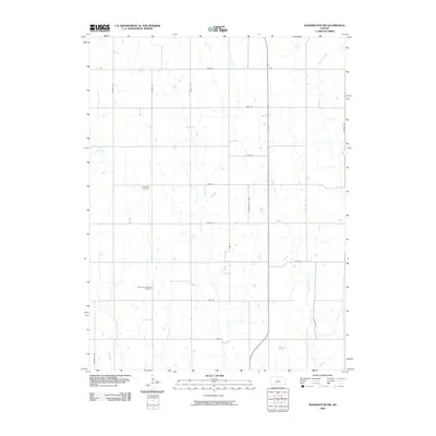
2009 Map of Washington NW
USGS Topo · Published 2009About this map
Bohemian National Cemetery and Greenfield Cemetery sit as quiet landmarks in this rural landscape of northern Kansas, reflecting the cultural heritage and early settlement of Washington County. The terrain is defined by a dense network of watercourses, including the central Salt Creek and the meandering Jones Creek, which have shaped the agricultural layout of the region. A rigid grid of gravel and dirt roads, such as Gypsum Rd and Heritage Rd, organizes the land into section-line tracts, while the path of Morrowville Blvd provides a key north-south artery. This 2009 survey shows a landscape almost entirely dedicated to cultivation and grazing, where the survival of small rural cemeteries and named drainage branches like Riddle Creek serves as the primary record of local geography and family history.
Find a feature on this map
24 named features on this map. Tap any name to fly to it.
Don’t see what you’re looking for? This feature index may not catch every label — zoom into the map to look around manually.
Map Details
Editions of this 2009 Washington NW Map
This is the sole edition of this map. No revisions or reprints were ever made.
Other maps of this area

1893 · Washington
USGS Topo · 1:125,000

1955 · Manhattan
USGS Topo · 1:250,000

1955 · Lincoln
USGS Topo · 1:250,000

1956 · Manhattan
USGS Topo · 1:250,000

1957 · Manhattan
USGS Topo · 1:250,000

1957 · Lincoln
USGS Topo · 1:250,000

1958 · Lincoln
USGS Topo · 1:250,000

1960 · Fairbury SW
USGS Topo · 1:24,000

1960 · Reynolds
USGS Topo · 1:24,000
1966 · Washington NW
USGS Topo · 1:24,000