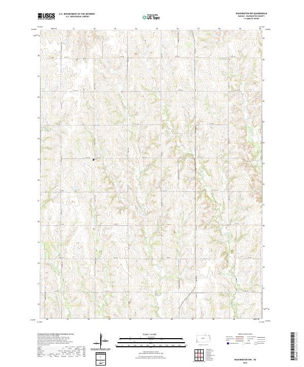
2022 Map of Washington NW
USGS Topo · Published 2022About this map
Greenfield Cem sits as a lonely historical marker in this agricultural section of Washington County, located near the intersection of Heritage Rd and 26th Rd. The landscape is defined by the intricate dendritic drainage patterns of several local waterways, including Salt Cr, Silver Cr, and the appropriately named Devils Cr. These streams carve through the terrain, creating a series of subtle ridges and valleys that dictate the placement of the section-line road network.
Find a feature on this map
27 named features on this map. Tap any name to fly to it.
Don’t see what you’re looking for? This feature index may not catch every label — zoom into the map to look around manually.
Map Details
Editions of this 2022 Washington NW Map
This is the sole edition of this map. No revisions or reprints were ever made.
Other maps of this area

1893 · Washington
USGS Topo · 1:125,000

1955 · Manhattan
USGS Topo · 1:250,000

1955 · Lincoln
USGS Topo · 1:250,000

1956 · Manhattan
USGS Topo · 1:250,000

1957 · Manhattan
USGS Topo · 1:250,000

1957 · Lincoln
USGS Topo · 1:250,000

1958 · Lincoln
USGS Topo · 1:250,000

1960 · Fairbury SW
USGS Topo · 1:24,000

1960 · Reynolds
USGS Topo · 1:24,000
1966 · Washington NW
USGS Topo · 1:24,000