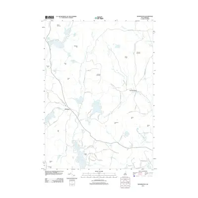
2012 Map of Washington
USGS Topo · Published 2012About this map
Washington serves as the primary settlement in this corner of Hillsborough County, surrounded by a complex network of ponds and granite highlands. The landscape is defined by its water bodies, from the expansive Highland Lake and Millen Lake to smaller, isolated features like Ayers Pond and Barney Pond. To the north, the terrain rises toward Lovewell Mountain and Bryant Mountain, while the Ashuelot River and its various tributaries, including Beard Brook and Shedd Brook, drain the wooded hills.
Find a feature on this map
87 named features on this map. Tap any name to fly to it.
Don’t see what you’re looking for? This feature index may not catch every label — zoom into the map to look around manually.
Map Details
Editions of this 2012 Washington Map
This is the sole edition of this map. No revisions or reprints were ever made.
Other maps of this area

1902 · Sunapee
USGS Topo · 1:62,500

1905 · Sunapee
USGS Topo · 1:62,500

1907 · Sunapee
USGS Topo · 1:62,500

1926 · Hillsboro
USGS Topo · 1:62,500

1928 · Mount Kearsarge
USGS Topo · 1:62,500

1929 · Hillsboro
USGS Topo · 1:62,500

1930 · Lovewell Mountain
USGS Topo · 1:62,500

1931 · Mount Kearsarge
USGS Topo · 1:62,500

1942 · Lovewell Mountain
USGS Topo · 1:62,500

1949 · Portland
USGS Topo · 1:250,000