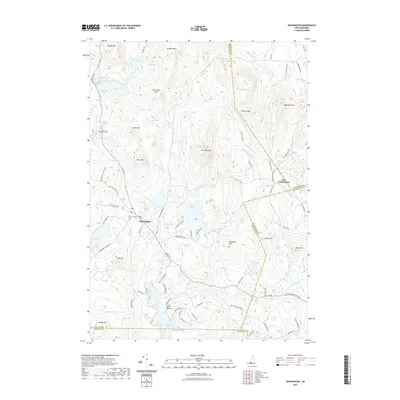
2021 Map of Washington
USGS Topo · Published 2021About this map
The town of Washington sits at a historic crossroads in the southwestern New Hampshire highlands, marked by the presence of the Center Cem and a network of roads leading toward local summits. The terrain is defined by a dense concentration of water bodies and high points, from the large expanse of Highland Lake near the settlement of North Outlet to the prominent peak of Lovewell Mtn. This landscape reveals a long history of upland settlement, where travel was dictated by ridges and water, as seen in the route of the 2nd New Hampshire Tpke and roads like Dole School House Rd that hint at former community centers. Further north, the village of East Washington is situated near Bradford Spring and Shedd Brook, illustrating the way early development clung to the valleys between heights like Avery Ledge and Sunapee Mtn.
Find a feature on this map
68 named features on this map. Tap any name to fly to it.
Don’t see what you’re looking for? This feature index may not catch every label — zoom into the map to look around manually.
Map Details
Editions of this 2021 Washington Map
This is the sole edition of this map. No revisions or reprints were ever made.
Other maps of this area

1902 · Sunapee
USGS Topo · 1:62,500

1905 · Sunapee
USGS Topo · 1:62,500

1907 · Sunapee
USGS Topo · 1:62,500

1926 · Hillsboro
USGS Topo · 1:62,500

1928 · Mount Kearsarge
USGS Topo · 1:62,500

1929 · Hillsboro
USGS Topo · 1:62,500

1930 · Lovewell Mountain
USGS Topo · 1:62,500

1931 · Mount Kearsarge
USGS Topo · 1:62,500

1942 · Lovewell Mountain
USGS Topo · 1:62,500

1949 · Portland
USGS Topo · 1:250,000