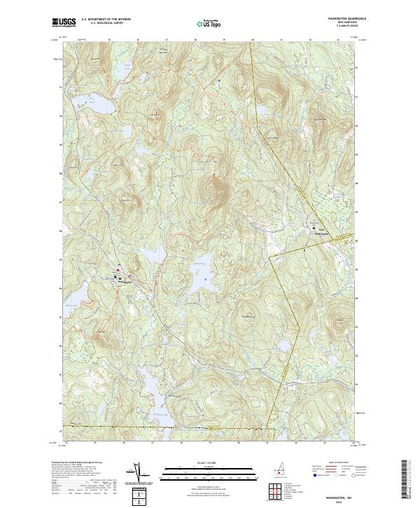
2024 Map of Washington
USGS Topo · Published 2024About this map
Washington and East Washington serve as the primary hubs of this landscape, situated amidst a high concentration of glacial ponds and granite peaks. The central settlement area is anchored by the Old Center Cem and New Center Cem, while the rugged eastern portion of the quadrangle is defined by Lovewell Mtn and the steep slopes of Avery Ledge. This modern survey reveals a highly preserved network of water bodies, from the sprawling Highland Lake in the south to the secluded Bear Pond near Sunapee Mountain.
Find a feature on this map
98 named features on this map. Tap any name to fly to it.
Don’t see what you’re looking for? This feature index may not catch every label — zoom into the map to look around manually.
Map Details
Editions of this 2024 Washington Map
This is the sole edition of this map. No revisions or reprints were ever made.
Other maps of this area

1902 · Sunapee
USGS Topo · 1:62,500

1905 · Sunapee
USGS Topo · 1:62,500

1907 · Sunapee
USGS Topo · 1:62,500

1926 · Hillsboro
USGS Topo · 1:62,500

1928 · Mount Kearsarge
USGS Topo · 1:62,500

1929 · Hillsboro
USGS Topo · 1:62,500

1930 · Lovewell Mountain
USGS Topo · 1:62,500

1931 · Mount Kearsarge
USGS Topo · 1:62,500

1942 · Lovewell Mountain
USGS Topo · 1:62,500

1949 · Portland
USGS Topo · 1:250,000