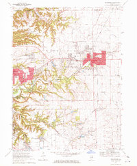
1970 Map of Washington
USGS Topo · Published 1972About this map
The city of Washington serves as the focal point for this 1970 survey, capturing a period of suburban expansion and industrial infrastructure between East Peoria and Eureka. Residential developments such as Harvard Hills and Beverly Manor contrast with the rugged, carved terrain of the Proving Ground to the north. This landscape is a crossroads of historic transportation, defined by the convergence of the Toledo Peoria and Western and the Atchison Topeka and Santa Fe railroads. Genealogists will find a wealth of local data, from established sites like Glendale Cemetery and Hollands Grove Cem to smaller burial grounds like Union Cem and Wrenn Cem. The map also documents specialized local features, including the Smitty Landing Strip, the Bible Camp near the Woodford County line, and a concentration of schools such as Columbia Sch and Pleasant View Sch.
Find a feature on this map
51 named features on this map. Tap any name to fly to it.
Don’t see what you’re looking for? This feature index may not catch every label — zoom into the map to look around manually.
Map Details
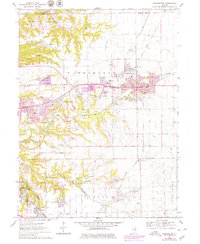
Editions of this 1970 Washington Map
2 editions found
Other maps of this area

1893 · Metamora
USGS Topo · 1:62,500

1893 · Dunlap
USGS Topo · 1:62,500

1898 · Dunlap
USGS Topo · 1:62,500

1905 · Peoria
USGS Topo · 1:62,500

1927 · Peoria
USGS Topo · 1:62,500

1928 · Mackinaw
USGS Topo · 1:62,500

1932 · Mackinaw
USGS Topo · 1:62,500

1932 · Dunlap
USGS Topo · 1:62,500

1933 · Dunlap
USGS Topo · 1:62,500

1937 · Metamora
USGS Topo · 1:62,500