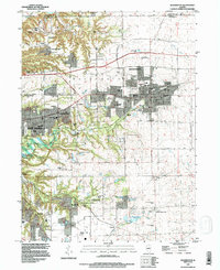
1995 Map of Washington
USGS Topo · Published 1996About this map
Washington and East Peoria serve as the primary hubs in this late twentieth-century landscape, where urban expansion meets the dissected terrain of the Illinois River bluffs. The map reveals a dense network of suburban development and civic infrastructure, including local landmarks like the Town Hall and numerous educational facilities such as Columbia Sch and Beverly Manor Sch. Outside the main town centers, the land is marked by small settlements like Crandall and residential pockets such as Harvard Hills, interspersed with public spaces like Birchwood Park and the Hillcrest Country Club.
Find a feature on this map
62 named features on this map. Tap any name to fly to it.
Don’t see what you’re looking for? This feature index may not catch every label — zoom into the map to look around manually.
Map Details
Editions of this 1995 Washington Map
This is the sole edition of this map. No revisions or reprints were ever made.
Other maps of this area

1893 · Metamora
USGS Topo · 1:62,500

1893 · Dunlap
USGS Topo · 1:62,500

1898 · Dunlap
USGS Topo · 1:62,500

1905 · Peoria
USGS Topo · 1:62,500

1927 · Peoria
USGS Topo · 1:62,500

1928 · Mackinaw
USGS Topo · 1:62,500

1932 · Mackinaw
USGS Topo · 1:62,500

1932 · Dunlap
USGS Topo · 1:62,500

1933 · Dunlap
USGS Topo · 1:62,500

1937 · Metamora
USGS Topo · 1:62,500