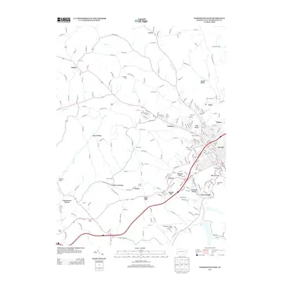
2013 Map of Washington West
USGS Topo · Published 2013About this map
Arden Mines and the nearby Arden Fairgrounds anchor the northern landscape of this region west of Washington, Pennsylvania. The area exhibits a mix of industrial history and institutional development, where the Finney Tunnel and the Washington County Airport mark significant transportation milestones. Smaller communities like Gabby Heights, Tylerdale, and Franklin Farms fill the space between the larger municipal boundaries, while the Brownson House stands as a notable landmark near the suburban edge. Waterways such as Chartiers Cr and Buffalo Cr carve through the terrain, defining the local topography around heights like Garrett Hill and Cemetery Hill. Community life is further evidenced by local centers like the Buffalo Grange and the Sunset Beach area in the southwest.
Find a feature on this map
224 named features on this map. Tap any name to fly to it.
Don’t see what you’re looking for? This feature index may not catch every label — zoom into the map to look around manually.
Map Details
Editions of this 2013 Washington West Map
This is the sole edition of this map. No revisions or reprints were ever made.
Other maps of this area

1901 · Amity
USGS Topo · 1:62,500

1904 · Amity
USGS Topo · 1:62,500

1904 · Carnegie
USGS Topo · 1:62,500

1904 · Burgettstown
USGS Topo · 1:62,500

1906 · Burgettstown
USGS Topo · 1:62,500

1906 · Carnegie
USGS Topo · 1:62,500

1907 · Claysville
USGS Topo · 1:62,500

1908 · Carnegie
USGS Topo · 1:62,500

1951 · Canton
USGS Topo · 1:250,000

1953 · Canton
USGS Topo · 1:250,000
Featured Places
- Washington, PA
- South Strabane Township, PA
- Buffalo, Hopewell Township
- Canton Township, PA
- Blaine Township, PA