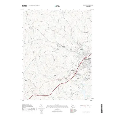
2019 Map of Washington West
USGS Topo · Published 2019About this map
Washington serves as the focal point of this western Pennsylvania landscape, where the urban grid meets the deeply dissected plateau of Washington County. The transition from industrial and residential centers like Tylerdale and Oak Grove to the surrounding hillsides reveals a history of resource extraction and infrastructure, most notably at the Arden Mines and along the path of the W & W RR. The terrain is defined by the winding courses of Chartiers Creek and Buffalo Cr, which have dictated the placement of early settlements and transportation corridors. To the west, the rural character remains dominant in places like Rural Valley and Taylorstown Station, while landmarks such as the Finney Tunnel and the Washington County Airport reflect the region's evolving logistical importance. Researchers can find numerous family-named hills and roads, alongside significant local burial grounds including Trinity Cem and Washington Cem.
Find a feature on this map
190 named features on this map. Tap any name to fly to it.
Don’t see what you’re looking for? This feature index may not catch every label — zoom into the map to look around manually.
Map Details
Editions of this 2019 Washington West Map
This is the sole edition of this map. No revisions or reprints were ever made.
Other maps of this area

1901 · Amity
USGS Topo · 1:62,500

1904 · Amity
USGS Topo · 1:62,500

1904 · Carnegie
USGS Topo · 1:62,500

1904 · Burgettstown
USGS Topo · 1:62,500

1906 · Burgettstown
USGS Topo · 1:62,500

1906 · Carnegie
USGS Topo · 1:62,500

1907 · Claysville
USGS Topo · 1:62,500

1908 · Carnegie
USGS Topo · 1:62,500

1951 · Canton
USGS Topo · 1:250,000

1953 · Canton
USGS Topo · 1:250,000
Featured Places
- Washington, PA
- South Strabane Township, PA
- Buffalo, Hopewell Township
- Canton Township, PA
- Blaine Township, PA