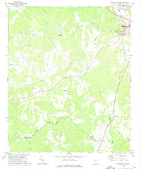
1972 Map of Washington West
USGS Topo · Published 1975About this map
The Little River and its northern tributaries define the undulating terrain of Wilkes County in the early 1970s. The western edge of Washington sits at the northeastern corner of the map, characterized by a concentration of infrastructure including a Filtration Plant, Water Tank, and a nearby Claypit. The landscape transitions from the developed fringes of the town into a mosaic of woodland and clearings, where small communities and rural intersections like Tyrone and Ficklin are situated.
Find a feature on this map
23 named features on this map. Tap any name to fly to it.
Don’t see what you’re looking for? This feature index may not catch every label — zoom into the map to look around manually.
Map Details
Editions of this 1972 Washington West Map
2 editions found
Other maps of this area

1906 · Crawfordville
USGS Topo · 1:125,000

1953 · Athens
USGS Topo · 1:250,000

1955 · Tignall
USGS Topo · 1:24,000

1958 · Athens
USGS Topo · 1:250,000

1959 · Athens
USGS Topo · 1:250,000

1963 · Athens
USGS Topo · 1:250,000

1966 · Philomath
USGS Topo · 1:24,000

1966 · Crawfordville
USGS Topo · 1:24,000
1971 · Celeste
USGS Topo · 1:24,000
1971 · Rayle
USGS Topo · 1:24,000