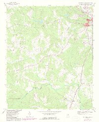
1972 Map of Washington West
USGS Topo · Published 1987About this map
The western outskirts of Washington define the upper reaches of this 1970s landscape, where the town's industrial and municipal development, including a Filtration Plant, Claypit, and Water Tank, meets the rural Piedmont of Georgia. The terrain is deeply carved by water, with the significant winding path of Kettle Creek and Beaverdam Creek flowing south toward the Little River. This hydrography dictated the placement of early settlements and road networks, visible in the clustering of crossroads like Tyrone and the string of community landmarks along the county line.
Find a feature on this map
20 named features on this map. Tap any name to fly to it.
Don’t see what you’re looking for? This feature index may not catch every label — zoom into the map to look around manually.
Map Details
Editions of this 1972 Washington West Map
2 editions found
Other maps of this area

1906 · Crawfordville
USGS Topo · 1:125,000

1953 · Athens
USGS Topo · 1:250,000

1955 · Tignall
USGS Topo · 1:24,000

1958 · Athens
USGS Topo · 1:250,000

1959 · Athens
USGS Topo · 1:250,000

1963 · Athens
USGS Topo · 1:250,000

1966 · Philomath
USGS Topo · 1:24,000

1966 · Crawfordville
USGS Topo · 1:24,000
1971 · Celeste
USGS Topo · 1:24,000
1971 · Rayle
USGS Topo · 1:24,000