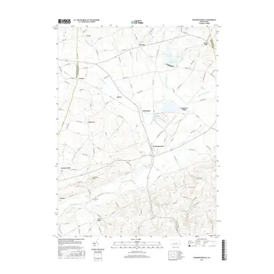
2016 Map of Washingtonville
USGS Topo · Published 2016About this map
Washingtonville serves as a central hub in this agricultural landscape of central Pennsylvania, where the borders of Northumberland, Montour, and Columbia counties converge. The topography is defined by the winding course of Chillisquaque Creek and its various branches, including the West Branch Chillisquaque Creek. Significant landmarks include the expansive Lake Chillisquaque with its distinct inlets at Goose Cove and Heron Cove. For genealogists and local historians, the map provides precise locations for several small settlements such as Strawberry Ridge, Exchange, and White Hall, alongside the Billimeyer Cem near the southern edge. The terrain is marked by Limestone Ridge, while a dense network of rural roads like Kelly's Dam Rd and Blue School Rd suggests long-established family homesteads and farmsteads scattered throughout the valleys.
Find a feature on this map
90 named features on this map. Tap any name to fly to it.
Don’t see what you’re looking for? This feature index may not catch every label — zoom into the map to look around manually.
Map Details
Editions of this 2016 Washingtonville Map
This is the sole edition of this map. No revisions or reprints were ever made.
Other maps of this area

1892 · Shamokin
USGS Topo · 1:62,500

1893 · Sunbury
USGS Topo · 1:62,500

1893 · Shamokin
USGS Topo · 1:62,500

1924 · Milton
USGS Topo · 1:62,500

1935 · Hughesville
USGS Topo · 1:62,500

1943 · Shamokin
USGS Topo · 1:62,500

1943 · Sunbury
USGS Topo · 1:62,500

1950 · Harrisburg
USGS Topo · 1:250,000

1952 · Shamokin
USGS Topo · 1:62,500

1953 · Hughesville
USGS Topo · 1:62,500