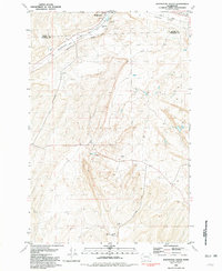
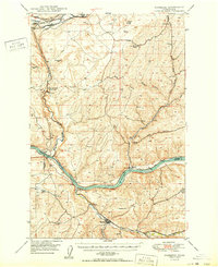
1981 Map of Washtucna South
USGS Topo · Published 1981About this map
Washtucna sits at the northern edge of this high-desert landscape where the Adams Co Franklin Co line divides the terrain. The town's location was historically dictated by the geography of the Washtucna Coulee, a significant dry channel that serves as a natural corridor for major transportation. In the early 1980s, this corridor remained a vital artery, occupied by both the Union Pacific and Burlington Northern railroads. To the south, the map reveals a rugged ranching environment characterized by isolated operations like the H U Ranch and Davin Ranch. Water is a scarce and precious resource in this basalt-carved country, marked by occasional features like Deep Lake and scattered springs. The presence of the Washtucna Airport and various Storage Bins underscores the region's focus on agricultural logistics and civil aviation during this era.
Find a feature on this map
16 named features on this map. Tap any name to fly to it.
Don’t see what you’re looking for? This feature index may not catch every label — zoom into the map to look around manually.
Map Details
Editions of this 1981 Washtucna South Map
This is the sole edition of this map. No revisions or reprints were ever made.
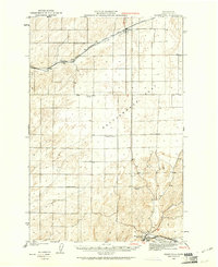
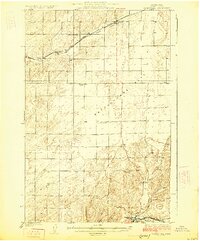
Other maps of this area
1923 · Washtucna
USGS Topo · 1:62,500
1925 · Washtucna
USGS Topo · 1:62,500
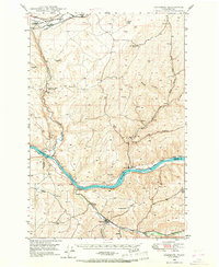
1948 · Starbuck
USGS Topo · 1:62,500

1948 · Ayer
USGS Topo · 1:62,500
1950 · Starbuck
USGS Topo · 1:62,500

1950 · Haas
USGS Topo · 1:62,500
1950 · Benge
USGS Topo · 1:62,500

1952 · Benge
USGS Topo · 1:62,500

1953 · Walla Walla
USGS Topo · 1:250,000

1958 · Walla Walla
USGS Topo · 1:250,000