
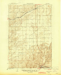
1925 Map of Washtucna
USGS Topo · Published 1925About this map
Chicago Milwaukee And ST Paul rails dominate the northern landscape of this 1920s Adams County survey, cutting a path through the coulees near Ralston and Pizarro. The map reveals a rural society structured around local education, with numerous small schoolhouses like Hillcrest School, Schaffer School, and Clever School serving the surrounding agricultural sections. The southern extent of the sheet focuses on the town of Washtucna, a critical junction where the Union Pacific and Spokane Portland And Seattle railroads converge.
Find a feature on this map
14 named features on this map. Tap any name to fly to it.
Don’t see what you’re looking for? This feature index may not catch every label — zoom into the map to look around manually.
Map Details
Editions of this 1925 Washtucna Map
2 editions found
Other maps of this area

1916 · Connell
USGS Topo · 1:125,000

1918 · Connell
USGS Topo · 1:125,000

1923 · Washtucna
USGS Topo · 1:62,500

1948 · Starbuck
USGS Topo · 1:62,500

1948 · Ayer
USGS Topo · 1:62,500

1950 · Starbuck
USGS Topo · 1:62,500

1950 · Haas
USGS Topo · 1:62,500

1950 · Benge
USGS Topo · 1:62,500

1952 · Benge
USGS Topo · 1:62,500

1953 · Walla Walla
USGS Topo · 1:250,000